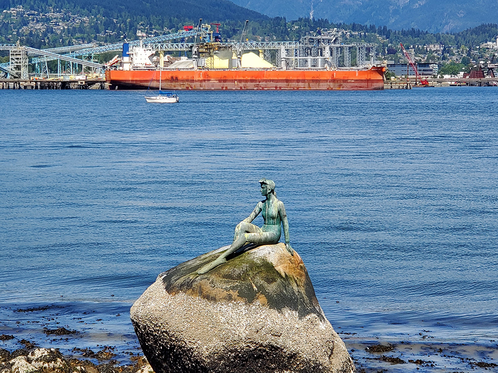
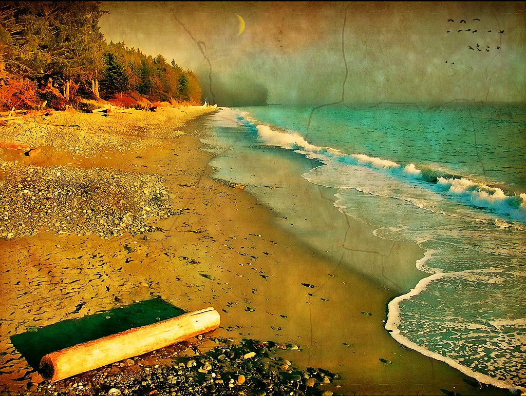
Girl in a Wetsuit is a life-size 1972 bronze sculpture by Elek Imredy of a woman in a wetsuit, located on a rock in the water along the north side of Stanley Park, Vancouver, British Columbia, Canada.
Every day, rain or shine, I stop my bicycle on the 10 km ride around the Seawall of Stanley Park and take a photo on my phone of Girl in a Wetsuit. My birthplace is over her shoulder and in all 1700+ snaps. Here is a small sample.
Girl in a Wetsuit Description
The bronze sculpture depicts a friend of Imredy’s, Debra Harrington, in a wetsuit with flippers on her feet and a mask on her forehead.
Controversy
Although some believe it was a replica of Copenhagen’s The Little Mermaid, the creator stated:
I didn’t believe we should have a copy of the mermaid. She is rightfully a symbol of Copenhagen… I proposed to have a life-size scuba diver seated there. At that time scuba diving was getting quite popular here in Vancouver and, just as important, I didn’t know of any similar sculpture anywhere in the world. It was a new idea… There was tremendous opposition and great controversy. I still don’t know why.
British Columbia in winter has a magic all of it’s own, not always sunshine and rainbows but when the combination of elements and weather conditions come together a majesty unfolds and wilderness becomes art.
There is nothing quite like the “snow crater” that forms beneath Wells Gray Provincial Park’s Helmcken Falls in the winter.
Helmcken Falls Snow Crater
Wells Gray Provincial Park was first established in November 1939, which means it just celebrated its 80th birthday.
The park is home to a beautiful waterfall that flows over a wide circular cliff during the warmer months of the year. According to Tourism Wells Gray, the drop is 141 meters.
Chasing Iconic Winter Waterfalls of Wells Gray
Uncover the mystical places that romantics, adventurers and photographers come here to find! With 41 named waterfalls (and counting!), and even more tucked into the wilds, discover why Wells Gray is also known as the land of waterfalls.
Ancient volcanoes and slow-moving glaciers carved the rivers and lakes that fuel the Park’s waterfalls. You’ll hear the roar of the Falls, long before you can see cascading water tumbling over lichen-drenched boulders, making its way downstream. Almost half the named Falls are found in the Corridor , mere minutes from Clearwater Valley Road.
Imagine a place where the Clearwater, Thompson and Murtle Rivers roar and wildlife sightings are as common as sunrise and sunset. A place where it’s easy to get off the beaten path, and away from the crowds, immersing yourself in real and wild nature. The place you imagine is Wells Gray Country, the mountain communities centered around Clearwater and Wells Gray Provincial Park. 5,250 square kilometres (1.3 million acres) of alpine wilderness, borne from volcanoes and carved by glaciers. It’s one of the most unique landscapes in all of B.C., where your days are measured in your steps hiked, wildlife sightings, and the number of waterfall shots on your camera.
It’s here, among old-growth inland rainforest and soaring mountain peaks that you’ll find your wild. During Spring, Summer and Fall you can hike through ancient forests, paddle pristine lakes, and raft on some of Canada’s fiercest rapids. In the winter, gaze upon frozen waterfalls and ski down untouched backcountry slopes.
Gold on my mind lately and learning for the first time about the Omineca Country, also the omineca geology of British Columbia and why the gold rushes happened. The word omineca was used in geology to describe a rift region of land, left behind after dramatic upheaval, followed by millions of years of glaciation and natural climate change.
Omineca River
Between the Rocky Mountains and the Pacific ocean lay a landscape that like the palm of your hand, can tell an amazing story, to an expert reader of such things. Terrains are the giant lines that form valleys and rivers, this is where the Omineca country is worn bare by the ions of time. This is where the immense heat was once generated when the earth’s crust, when it was sheared from beneath by eruptions of magma. This is where gold is born.
British Columbia
The Omineca Gold Rush was a gold rush in British Columbia, Canada in the Omineca region of the Northern Interior of the province. Gold was first discovered there in 1861, but the rush didn’t begin until late in 1869 with the discovery at Vital Creek.
There were several routes to the goldfields: two were from Fort St. James, one of which was a water route through the Stuart and Tachie Rivers to Trembleur Lake to Takla Lake and the other was overland, called the Baldy Mountain route.
British Columbia gold rushes were important episodes in the history and settlement of European, Canadian and Chinese peoples in western Canada.
The presence of gold in what is now British Columbia is spoken of in many old legends that, in part, led to its discovery. The Strait of Anian, claimed to have been sailed by Juan de Fuca for whom today’s Strait of Juan de Fuca is named, was described as passing through a land (Anian) “rich in gold, silver, pearls and fur”. Bergi (meaning “mountains”), another legendary land near Anian, was also said to be rich in gold as well.
Speculative maps of northwestern North America published before the area was mapped placed the legendary golden cities of Quivira and Cibola in the far inland northwest. No Spanish exploration parties in search of El Dorado, “the golden one” a reference to the legendary king of a lost golden city, are known to have ever reached British Columbia, although archaeological remains point to a brief Spanish presence in the Okanagan and Similkameen regions of the province’s Southern Interior.
The Muchalaht, the Nuu-chah-nulth group in the area of the community of Gold River, on Vancouver Island, which is a community at the end of a fjord that drains the west coast of Vancouver Island, tell a story of Spanish arriving then burning the valley searching for gold. Prospectors searching the valley have found old crude dug adits on the pass of the White River Valley and the Gold River Valley.
60 meters taller than Mount Robson, standing at 4019 meters, Mount Waddington is the 3rd tallest mountain in British Columbia, after Mount Fairweather and Quincy Adams peaks on the Alaskan border. The mountain also has the second highest prominence in BC, at 3289 meters. Standing at the head of the Bute and Knight Inlets, the mountain is surrounded by such rugged, remote terrain that it is rare to even be able to see the peak.Mount Waddington Photo credit Kevin Teague (kteague)
Thank YouTube for giving us such an amazing platform for Left Coast Media, even if YT made mistakes with censorship and for unfair practices (towards some content creators) we can forgive them, or we never would see the Levi Allen video of a Man Riding a Walmart Raft off a 1000 ft. Waterfall.
Left Coast Media and the Slacklife Series was something I stumbled on today as I was seeking BC sailing videos and for the first time saw Levi Allen, and totally dug his style immediately.
The falls were named in 1947 after a Chilcotin Chief named Hana-lin, who used to fish below the falls in the autumn with a fish trap, and trap game nearby. In the 1930s it was sometimes called Mystery Falls and before that occasionally called Bella Coola Falls
Left Coast Media and the Slacklife Series create content that takes you into these incredible super natural places.
French Beach, Vancouver Island, near Sooke, British Columbia
The town of Sooke is another place in British Columbia that I have not seen and even though I won’t admit to a bucket list, there are some place I just feel I must go an experience for myself. That being said; Sooke British Columbia is high on the list.
Sooke’s popularity as a scenic tourist destination has existed for generations. Well-known destinations in Sooke, such as Whiffin Spit Park, the Sooke Potholes Regional Park and adjacent Sooke Potholes Provincial Park attract visitors both locally and from around the world. Sooke is also home to the Sooke Region Museum and Visitor Centre; where visitors and locals are able to get information on regional attractions and history.
Sooke Basin View by Kiwibirdman
The area’s popularity has increased as a base for visiting the wilderness parks of Vancouver Island‘s southwest coast — the West Coast Trail and the Juan de Fuca Provincial Park which includes the now highly popular Juan de Fuca Marine Trail. Sooke, BC is also famous for its beaches just on the outskirts of its neighbouring communities such as Shirley and Jordan River. These beaches include Sandcut, French beach, Fishboat bay, China beach, Mystic beach and more.
To get an idea of how amazing awesome the beaches are near Sooke, check out this fabulous short video
The beaches near Sooke, BC in one day
Back country recreation, or off-road
recreation brings a constant stream of 4X4s, quads, ATVs, dirt bikes
and home built off-highway vehicles through Sooke as people search out
back country access. Hundreds of kilometres of logging roads thread
through the hills north of Sooke in the Rural Resource Lands of the Juan
de Fuca electoral area, enabling access to several community lakes and
small reservoirs. Two large reservoirs, Bear Creek and Diversion, are
popular destinations north and west of Sooke.
Mountain biking is growing in popularity in British Columbia,
and Sooke is establishing itself as a destination for the sport. Local
advocacy groups such as the Sooke Bike Club are working to have areas
such as Broom Hill set aside as parkland.
The Coquihalla is the name of the highway that connects Vancouver to the Okanagan Valley, an absolute marvel of road building and maintenance, there’s even been a show created around winter time problems on that road. I like the video called The Coquihalla: 20 Months Through the Mountains – a 1985 film about the construction of the highway.
The film above was created in 1985 and depicts some of the jobs I was working back in that day, such as operating earth moving equipment and drilling and blasting, this was work I was involved in as a young man. Growing up in British Columbia, the Coquihalla was a really big deal.
Highway Thru Hell is a Canadian reality TV show that follows the operations of Jamie Davis Motor Trucking, a heavy vehicle rescue and recovery towing company based in Hope, British Columbia. Quiring Towing, Aggressive Towing and Mission Towing are also big players in the series. The show focuses on the hardships of operating along the highways of the BC Interior, especially the Coquihalla Highway (Coq).
Coquihalla Summit Rest Area (el. 1,244 m or 4,081 ft) is a highway summit along the Coquihalla Highway in British Columbia, Canada. It is the highest point on the highway between the cities of Hope and Merritt. It is located just south of the former toll booth plaza on the Coquihalla Highway, about 50 km (31 mi) north of Hope, and 65 km (40 mi) south of Merritt and is the divide between the Coquihalla River and the Coldwater River.
Coquihalla Summit is the Surrey Lake Summit at 1444 m (4738) and
is the highest point on the Coquihalla which goes from Hope to the
highway 1 interchange outside of Kamloops.
The ascent to the Coquihalla Summit is very steep, especially from the south, and is particularly steep north of the Great Bear snow shed. The pass is named after the Coquihalla River, from which the highway also derived its name. The Coquihalla Summit Recreation Area is located at the top of the pass on the Coquihalla Highway, approximately 45 km (28 mi) north of Hope.
Coquihalla Box Canyon Chain Up Area
History
Kw’ikw’iya:la (Coquihalla) in the Halq’emeylem language of the Stó:lō,
is a place name meaning “stingy container.” It refers to a fishing rock
near the mouth of what is now known as the Coquihalla River. This rock
is a good platform for spearing salmon. According to Sto;lo oral
history, the skw’exweq (water babies or naiads,
underwater people) who inhabit a pool close by the rock, would swim out
and pull the salmon off the spears, allowing only certain fisherman to
catch the salmon.
Coquihalla
The Coquihalla Valley has long been a major transportation route from the coast to the interior. in 1876, the Hope-Nicola Trail was built. The area retains some remnants of the Kettle Valley Railway which travelled this route from early 1900s until 1961. Modern use of the pass began in 1986 after construction of the first phase of the Coquihalla Highway (from Hope to Merritt). Construction of this part of the Coquihalla Highway was spearheaded by Tom Waterland as MLA for Yale-Lillooet. His “conviction that the route provided important benefits and an essential link to B.C.’s Interior… helped to convince reluctant Cabinet members of the necessity of the third route to the Interior”. After 10 years in office, Waterland retired from the Cabinet in 1986 a few months after seeing this part of the project through to its completion. Some of the old railroad grade is now part of the Trans-Canada Trail network, including the Othello Tunnels of the Coquihalla River section, which are accessible via exits from the Coquihalla Highway. A series of protected areas were established along the route in 1986.
Following nine days of snowfall in February 2014, there was a Class 4 avalanche across the Coquihalla Highway, 33 kilometres (21 mi) north of Hope on February 20, 2014 which required the use of explosives, dropped from helicopters, and took three days to clear.
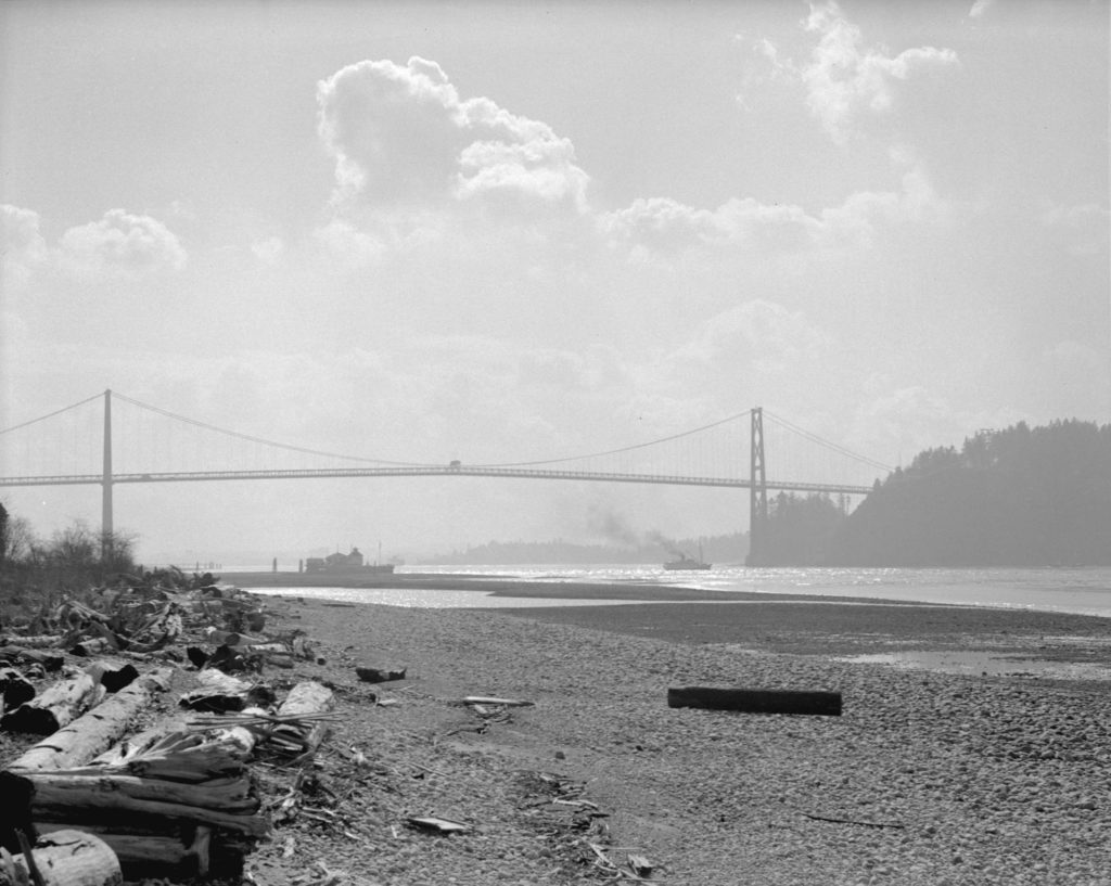
I was riding my bicycle across the overpass in Stanley Park and stopped in the middle to admire the perfect view of Lions Gate Bridge, when I noticed a little plaque that said the following:
The Guinness brewing family built the Lions Gate Bridge which opened in 1938 to provide access to its British Properties lands in West Vancouver. Ownership was transferred to the Province in 1955. Tolls were removed in 1963 and the bridge was restored in 1998 after a long debate about its heritage value and capacity.
The most beautiful bridge north of San Francisco’s Golden Gate, Lions
Gate Bridge brought Vancouver into the automobile age and heralded the
era of auto-dependent suburbs when it opened in 1938. The Guinness
brewing company was the primary financier, intent on providing access to
its British Properties development in West Vancouver. Bisecting Stanley
Park for the bridge’s causeway was the most controversial issue, but
the proponents’ promise of jobs was too good to turn down, as the city
was mired in the Great Depression. In 1933, the Park Board voted in
favour of it, with only one commissioner opposed.
“Lady Cecilia” under the Lions Gate Bridge 1939. City of Vancouver Archives, CVA 99-2951, photographer Start Thomson
The idea to build a bridge across First Narrows was investigated as
early as the 1890s, but it wasn’t until the 1920s that plans began to
take shape. In December 1933, approval for the building of the bridge
was reached through a city wide vote. Construction began on March 31,
1937 by clearing ten acres of Stanley Park to create the right-of-way.
Upon completion in November 1938, the Lions Gate Bridge was recognized
as the longest suspension bridge in the British Empire and one of the
biggest construction projects undertaken in Canada during the 1930s.
Despite its great size, the open steelwork of the twin towers gives the
structure a weightless quality that blends well with its picturesque
setting.
The bridge was remarkable because of its length and the technical
innovations in cable use and construction. Alfred J.T. Taylor, a
prominent engineering contractor and industrialist who had substantial
land holdings on the North Shore and who assembled the financing for the
project has been called the visionary behind the project. The Guinness
brewing company acted as the primary financier, intent on providing
access to its British Properties development in West Vancouver.
Named in honour of a pair of pointed peaks along the North Shore
mountain range known as ‘The Lions’, the south entrance to the bridge is
graced by two monumental Art Deco lion figures which were the last
great public work of Vancouver’s foremost sculptor, Charles Marega.
The provincial government purchased it in 1955, its “Year of
Bridges”. Other projects in the region included the Second Narrows and
Oak Street bridges plus Highway 99 and the south arm crossing that
became George Massey Tunnel. A third lane was squeezed onto Lions Gate
Bridge to accommodate the increasing traffic volume. It ceased to be a
toll bridge in 1963. Overcrowded for decades, the bridge narrowly
avoided demolition in the 1990s, instead being refurbished by the
provincial government. Its retention indicated the city was beginning to
move beyond the automobile age.
The Jumbo Valley, located deep in the wilds of British Columbia’s Purcell Mountains, has long been revered for its spiritual significance and beauty. To the Ktunaxa Nation, it is known as Qat’muk, home of the grizzly bear spirit.
Part of a crucial international wildlife corridor, the Jumbo Valley is one of only two remaining areas in North America where bears can freely roam between Canada and the US. Permanent development of the valley would likely lead to reduced grizzly populations locally, regionally and even continentally.
For nearly 25 years, local people—First Nations, skiers, riders, alpinists and conservationists—have fought a proposed large-scale ski resort in Jumbo. The Ktunaxa First Nation’s Qat’muk Declaration asserts that the Jumbo Valley is of significant spiritual and ecological importance and calls for its permanent protection.
[box type=”tick” style=”rounded” border=”full”]There are few places left like this in the world and it is our duty to make sure the Jumbo Valley remains intact now and long into the future.[/box]
Created by the construction of Mica Dam on the Columbia River, Kinbasket Lake (For a short time known as McNaughton Lake) sits in the Rocky Mountain Trench on the Western edge of the Rockies. On the Western side of the Trench lies the Purcell and Selkirk Ranges of the Columbia Mountains.
Coming to theatres Oct 2015 – Patagonia presents Jumbo Wild – a gripping, hour-long documentary film by Sweetgrass Productions that tells the true story of the decades-long battle over the future of British Columbia’s iconic Jumbo Valley and highlights the tension between the protection of wilderness and the backcountry experience and ever-increasing development interests in wild places. Set against a backdrop of incredible backcountry ski and snowboard footage, Jumbo Wild documents all sides of a divisive issue bringing the passionate local fight to protect the Jumbo Valley to life for the first time.


You must be logged in to post a comment.